

Building a 10M+ Download GPS Area Measurement App for Farmers & Surveyors
Limbani Softwares built FieldCalc, a GPS land measurement app with 10M+ downloads and 124K ratings on Google Play. Accurate area, perimeter, and distance measurement for Android.


Industry
Utility & Geospatial Technology
Project Type
Mobile Application Development
Platform
Android & IOS
Services Provided
Mobile App Development, GPS & Maps Integration, UI/UX Design, Monetization
The Solution
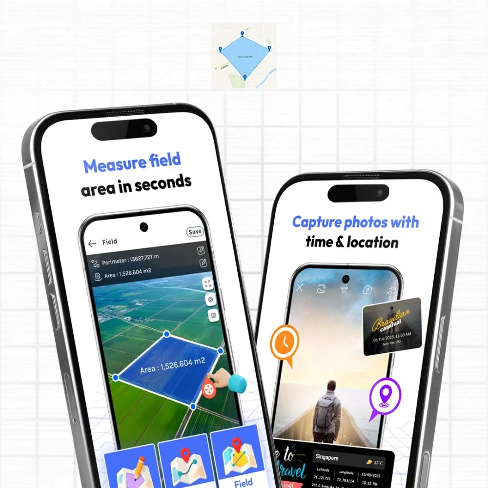
A GPS-powered app for measuring land area, perimeter, acreage, and distance on Android.
GPS Field Area Measurement
Measure land by walking or driving property boundaries with real-time GPS tracking for accurate area and perimeter calculations.
Map-Based Area Calculator
Draw any shape directly on the map to instantly calculate area and perimeter without visiting the physical location.
Distance & Route Measurement
Measure distances between multiple points for fences, roads, pathways, and property boundaries with ease.
Acreage & Unit Conversion
Automatically convert measurements into acres, hectares, square feet, square meters, and other popular units.
Offline Measurement Support
Measure land and calculate distances even without internet access, ideal for remote and rural locations.
Technologies & Tools
Built with Android, Google Maps, GPS APIs, Firebase, AdMob, and Google Play Billing for measurement, analytics, and monetization.




Development Process
The development process involved the following stages:

Researched key users and defined features based on real-world land measurement needs.

Supported both GPS tracking and map drawing to serve different user workflows.

Designed for outdoor use with a focus on speed, visibility, and ease of use.

Integrated GPS and maps for accurate measurements across varied land shapes.

Enabled measurements without internet access for remote and rural environments.

Continuously improved performance and stability through user feedback and updates.
Challenges
Ensuring accurate GPS measurements across different terrains was the biggest challenge, as signal quality varies between open fields, slopes, and dense forests. We also optimized real-time GPS tracking and map rendering to reduce lag and battery usage. Supporting both GPS-based and map-based measurements within a simple, user-friendly interface required careful UX planning and extensive testing.

Project Requirements
The app needed to measure land area, perimeter, acreage, and distances accurately on an Android device without requiring an internet connection in the field. It had to support both GPS-based and map-based measurement methods, handle irregular shapes reliably, convert between multiple measurement units automatically, and work for a wide range of users from working farmers to homeowners without assuming any technical background.

Unique Value
Most people who need to measure land don't have the budget or the ongoing need for professional surveying equipment. FieldCalc addresses that directly. With 10M+ downloads and 124K ratings on Google Play, it's one of the most widely used land measurement tools on Android. It works offline, handles irregular shapes, supports every common measurement unit, and gets from app open to a usable result in under a minute.